Mont-Saint-Hilaire is a French suburb of Montreal located in southeastern Quebec and is named after the mountain located in the town’s southern region. A local bus service operates in Mont-Saint-Hilaire and the town is also home to a commuter rail station.
Mont-Saint-Hilaire
Fortier Street
The case study conducted on Fortier Street was one of the nine studies included in Montreal Urban Ecology Centre’s report analyzing complete street transformations across the province of Quebec.
Project Information
- Street category: Commercial street
- Project length: 1.2 km
- Total cost: $5.2 M
- Cost per km: $4.3 M
- Year of implementation: 2007
Fortier Street and a part of the Chemin Ozias-Leduc were modernized to promote active transportation and better sharing of this street characterized by high vehicle traffic. The cities of Mont-Saint-Hilaire and Otterburn Park collaborated on the project, especially the part involving the Chemin Ozias-Leduc, which connects the two cities. This redevelopment project was enhanced by other interventions, such as the creation of safe intersections under the Plan de mobilité active (2013).
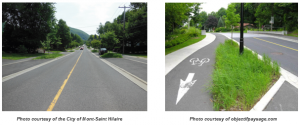
Before After
Pedestrian infrastructure
The sidewalks on either side of the roadway are protected from vehicle traffic by a unidirectional bicycle path, a vegetative strip and a parking lane. Paving stone installed at certain intersections ensures safe pedestrian travel.
Universal accessibility
At intersections, the sidewalks were brought to street level.
Cycling infrastructure
The street was reconfigured mainly to add unidirectional bicycle paths on each side. These paths are level with the sidewalk and protected from the roadway by vegetative strips and parking lanes. Vélo Quebec made recommendations regarding the preferred cycling infrastructure.
Public transit
Bus 21, operated by Exo, services the street. However, the few existing stops have been neither redesigned nor equipped with bus shelters or benches.
Participatory process
A few meetings were held in 2006 to explain how the design of the Fortier Street redevelopment evolved and to allow citizens to submit briefs indicating their impressions.
Key elements: Landscaping and traffic calming
One of the goals of the redevelopment project was to increase greening along the artery. The street is now lined with vegetative strips, comprising trees, plants and grassy areas. The addition of greening helped to create an impression of narrowness so as to reduce vehicle speeds.
Cross section: Corner of Ernest Choquette Street
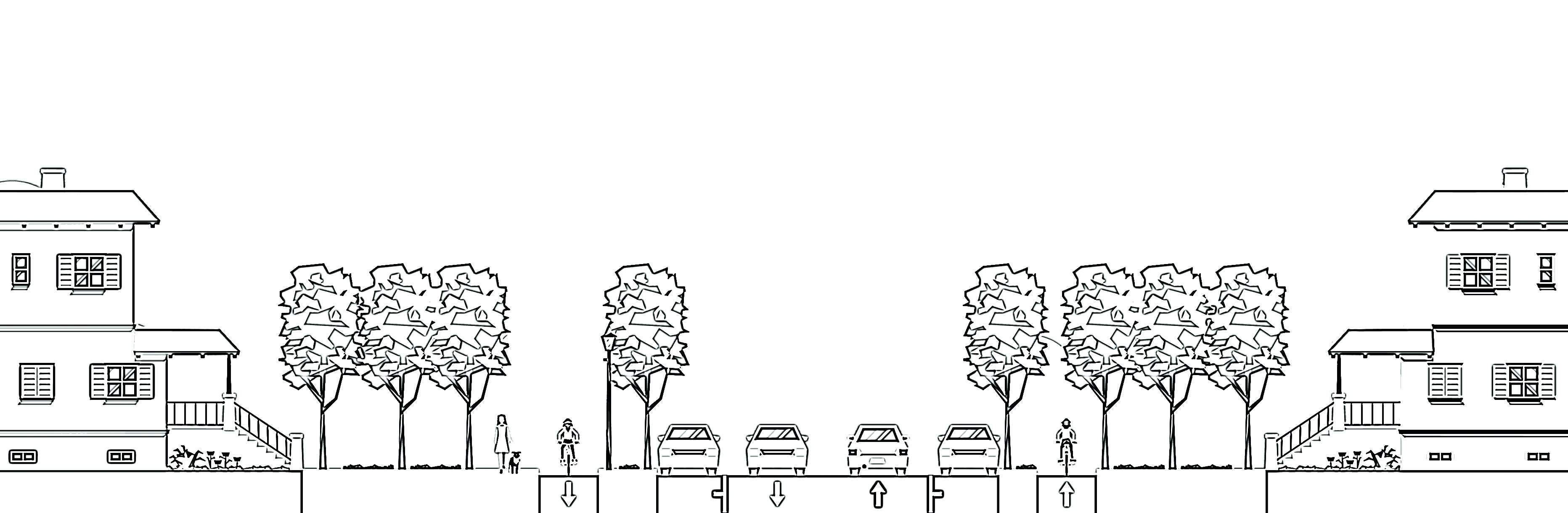
Total pavement: +/-15 metres